

Since the advent of global positioning satellites, or at least since their availability to civilians, scientists have found many uses for these devices. One of the more interesting applications is to track animals, as in the “fish with chips” program. This is a multimillion dollar Census of Marine Life project. In conjunction with this program, thousands of marine animals in the Pacific Ocean, including many fish, have been fitted with electronic surveillance tags.
As of 2005, midpoint in a ten year program, some interesting results have been recorded. Thus far about 1800 sharks, tuna and turtles have been fitted with transmitting devices which relay information to a satellite when the animal surfaces.
By this means, a bluefin tuna was tracked as it crossed the Pacific Ocean three times in 600 days. This fish swam 40,000 km with an average of 66 km/day.
More dramatic still were the exploits of Nicole, a 3.5m long great white shark. This specimen swam 11,000 km from South Africa to Australia and back within three months. Nicole thus averaged 122 km/day. She swam in a straight line, never less than 5km/hr, and 60% of the time she stayed within one metre of the surface. It is obvious she knew where she was going.
Scientists have been astonished to discover how far these and many other animals migrate. Another interesting study involved young fingerling salmon emerging from 16 river systems on the Pacific coast of North America. The tags on several thousand of these fish were scanned as they passed over special receivers placed on the ocean floor from Washington State up to Alaska. This study revealed that the young salmon follow precise migration paths which vary depending upon their river of origin.
The results of these tracking studies intensify the question, long pondered, as to how animals navigate long precise routes through the oceans or skies. As our tools for study become ever more sophisticated, our insights might be expected to increase too. This may be, but the more famous cases still abound in unanswered questions.
Arctic birds
In certain instances a simple navigating system may suit the needs of an animal. This situation applies for example to arctic birds on their annual migration south. Navigation apparently is most difficult near the poles since many useful parameters, like magnetic field, all converge.
During the late summer of 2005, scientists carried out a study of arctic bird navigation. As flocks of birds passed over the Bering Strait between Alaska and Siberia, scientists briefly tracked them by radar. From hundreds of such tracks, the travel trajectories (direction) could be calculated.
The scientists had already calculated the various routes that birds would follow if they were using one or other navigational cue. If the birds were navigating by means of a magnetic compass, for example, they would proceed towards the northeast (not an ideal direction). If they used the sun as their reference point, adjusting their calculations according to time of day, they would proceed towards the east. However if they followed the sun without adjusting direction for time of day, they would proceed in a southeast direction. This was indeed the path these birds appeared to follow.
The end result of this strategy is that their route then traces an arc, part of a great circle. Such a route is by definition the shortest distance connecting two points on the globe. For people relying on technology, a great arc requires continuous changes in compass direction. Navigating by compass (magnetic field) is longer but much easier. Obviously however one expends less energy on a shorter route. In the case of arctic birds, lacking complex computer programs, they nevertheless manage to follow a sophisticated path out of the arctic. Scientists cannot refrain from asking how these birds learned such a navigational strategy.
There is no doubt that recent tracking studies have revealed exciting details about animal navigation. In addition, physiological studies continue to give us glimpses into methods which these creatures use to plot their routes. None of these environmental cues however would be any help at all without senses designed to perceive them, and brains to interpret the data correctly, and to act upon it. Secular scientists may eventually describe the tracking mechanisms ever so precisely, but they will never be able to tell us why or how these remarkable designs were conferred on these creatures. These talents obviously are a design feature programmed into the animal brains.
Sea Turtles
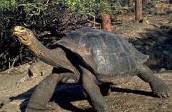 Most of the seven species of sea turtle can be found throughout the world’s tropical and subtropical seas. Despite this wide range, local populations exhibit very specific nesting site preferences and sometimes even a specific preference in feeding site as well. This scarcely seems remarkable until we realize that the nesting and feeding sites may be thousands of kilometers apart. After decades of ecological studies, scientists still have only a poor understanding of the wonders of sea turtle navigation.
Green turtles are a rugged, long lived species (up to 70 years). As is typical with sea turtles, the female lays her eggs at night in the sand of a wide beach along the seashore. She digs a pit, and lays as many as one hundred eggs. After covering the eggs, the mother then retreats into the sea. Several weeks later, all the eggs hatch at the same time. The hatchlings emerge from the sand and head straight for the ocean. Once immersed, they swim straight out, farther and farther from land with its multitude of avian, crustacean and human predators. Only about one in one thousand hatchlings survives long enough to mature.
Once in the open sea, young turtles apparently set out for the feeding grounds. Green turtles hatched on beaches of Costa Rica, later turn up in Spain, Chile and Brazil. Then once mature, females return to the very same beaches from which they hatched fifteen to thirty years previously. Tagging programs with young turtles have never revealed an adult female nesting on a beach other than the one from which she emerged. How do these turtles, out at sea, navigate towards the appropriate beach?
One of the more remote destinations on earth is Ascension Island. Situated in mid South Atlantic Ocean, this island of 88 square kilometers lies about 1100 kilometres northwest of Saint Helena, itself an island famous for its remote location. Napoleon Bonaparte spent his last days on Saint Helena, a site chosen as his prison because its distance from everywhere made escape impossible. However Ascension Island is even more isolated than Saint Helena. Nevertheless green turtles, feeding in shallow waters along the Brazilian coast, and others in similar habitats near Gabon (Africa), swim due east or west (respectively) to nest on the beaches of Ascension Island. The journey from Africa to the island is 2500 km and from Brazil to the island is 2250 km. It is like finding a needle in a haystack. Nevertheless adult female turtles make the journey once every three to four years. Moreover they do not eat at all during the entire eight month return trip.
Amazing skills in navigation are not unique to green sea turtles. Studies on the largest turtle of all, the leatherback, reveal some interesting details too. Unlike the green turtle, the leatherback forages for food in the deep ocean so and so is less tied to specific feeding grounds. Nevertheless there are only a few dozen places in the world where these turtles lay eggs.
Of these, only four beaches attract large numbers of nesting leatherbacks. One of these four beaches is Playa Grande Beach on the west coast of Costa Rica. Tagging studies have revealed that these turtles travel 2500 km west from Costa Rica toward the Galapagos Islands and beyond into deeper waters. They confine this travel to a narrow corridor up to 480 km wide. The females however return to Playa Grande to lay eggs up to ten times per season. The females of another leatherback population, which feeds on jellyfish in the waters off Canada?s Nova Scotia coast, later proceed to beaches within the Caribbean Sea in order to nest.
Studies on turtle navigation have revealed that young hatchlings react positively to wave direction, the earth?s magnetic field, moonlight, and perhaps chemical gradients. Nobody has however established precisely how adult turtles navigate thousands of kilometers in the open ocean, or even why they do so. Even if turtles are able to orient themselves in a specific direction, how do they locate the particular beach from which they hatched so many years previously and on which they spent so short a time?
Research challenge: Investigate another amazing story of animal migration such as monarch butterflies, freshwater eels or various birds.
Margaret Helder
April 2006
Subscribe to Dialogue
FEATURED BOOKS AND DVDS

Hardcover / $18.00 / 125 Pages / full colour
Since the advent of global positioning satellites, or at least since their availability to civilians, scientists have found many uses for these devices. One of the more interesting applications is to track animals, as in the “fish with chips” program. This is a multimillion dollar Census of Marine Life project. In conjunction with this program, thousands of marine animals in the Pacific Ocean, including many fish, have been fitted with electronic surveillance tags.
As of 2005, midpoint in a ten year program, some interesting results have been recorded. Thus far about 1800 sharks, tuna and turtles have been fitted with transmitting devices which relay information to a satellite when the animal surfaces.
By this means, a bluefin tuna was tracked as it crossed the Pacific Ocean three times in 600 days. This fish swam 40,000 km with an average of 66 km/day.
More dramatic still were the exploits of Nicole, a 3.5m long great white shark. This specimen swam 11,000 km from South Africa to Australia and back within three months. Nicole thus averaged 122 km/day. She swam in a straight line, never less than 5km/hr, and 60% of the time she stayed within one metre of the surface. It is obvious she knew where she was going.
Scientists have been astonished to discover how far these and many other animals migrate. Another interesting study involved young fingerling salmon emerging from 16 river systems on the Pacific coast of North America. The tags on several thousand of these fish were scanned as they passed over special receivers placed on the ocean floor from Washington State up to Alaska. This study revealed that the young salmon follow precise migration paths which vary depending upon their river of origin.
The results of these tracking studies intensify the question, long pondered, as to how animals navigate long precise routes through the oceans or skies. As our tools for study become ever more sophisticated, our insights might be expected to increase too. This may be, but the more famous cases still abound in unanswered questions.
Arctic birds
In certain instances a simple navigating system may suit the needs of an animal. This situation applies for example to arctic birds on their annual migration south. Navigation apparently is most difficult near the poles since many useful parameters, like magnetic field, all converge.
During the late summer of 2005, scientists carried out a study of arctic bird navigation. As flocks of birds passed over the Bering Strait between Alaska and Siberia, scientists briefly tracked them by radar. From hundreds of such tracks, the travel trajectories (direction) could be calculated.
The scientists had already calculated the various routes that birds would follow if they were using one or other navigational cue. If the birds were navigating by means of a magnetic compass, for example, they would proceed towards the northeast (not an ideal direction). If they used the sun as their reference point, adjusting their calculations according to time of day, they would proceed towards the east. However if they followed the sun without adjusting direction for time of day, they would proceed in a southeast direction. This was indeed the path these birds appeared to follow.
The end result of this strategy is that their route then traces an arc, part of a great circle. Such a route is by definition the shortest distance connecting two points on the globe. For people relying on technology, a great arc requires continuous changes in compass direction. Navigating by compass (magnetic field) is longer but much easier. Obviously however one expends less energy on a shorter route. In the case of arctic birds, lacking complex computer programs, they nevertheless manage to follow a sophisticated path out of the arctic. Scientists cannot refrain from asking how these birds learned such a navigational strategy.
There is no doubt that recent tracking studies have revealed exciting details about animal navigation. In addition, physiological studies continue to give us glimpses into methods which these creatures use to plot their routes. None of these environmental cues however would be any help at all without senses designed to perceive them, and brains to interpret the data correctly, and to act upon it. Secular scientists may eventually describe the tracking mechanisms ever so precisely, but they will never be able to tell us why or how these remarkable designs were conferred on these creatures. These talents obviously are a design feature programmed into the animal brains.
Sea Turtles
Most of the seven species of sea turtle can be found throughout the world’s tropical and subtropical seas. Despite this wide range, local populations exhibit very specific nesting site preferences and sometimes even a specific preference in feeding site as well. This scarcely seems remarkable until we realize that the nesting and feeding sites may be thousands of kilometers apart. After decades of ecological studies, scientists still have only a poor understanding of the wonders of sea turtle navigation.
Green turtles are a rugged, long lived species (up to 70 years). As is typical with sea turtles, the female lays her eggs at night in the sand of a wide beach along the seashore. She digs a pit, and lays as many as one hundred eggs. After covering the eggs, the mother then retreats into the sea. Several weeks later, all the eggs hatch at the same time. The hatchlings emerge from the sand and head straight for the ocean. Once immersed, they swim straight out, farther and farther from land with its multitude of avian, crustacean and human predators. Only about one in one thousand hatchlings survives long enough to mature.
Once in the open sea, young turtles apparently set out for the feeding grounds. Green turtles hatched on beaches of Costa Rica, later turn up in Spain, Chile and Brazil. Then once mature, females return to the very same beaches from which they hatched fifteen to thirty years previously. Tagging programs with young turtles have never revealed an adult female nesting on a beach other than the one from which she emerged. How do these turtles, out at sea, navigate towards the appropriate beach?
One of the more remote destinations on earth is Ascension Island. Situated in mid South Atlantic Ocean, this island of 88 square kilometers lies about 1100 kilometres northwest of Saint Helena, itself an island famous for its remote location. Napoleon Bonaparte spent his last days on Saint Helena, a site chosen as his prison because its distance from everywhere made escape impossible. However Ascension Island is even more isolated than Saint Helena. Nevertheless green turtles, feeding in shallow waters along the Brazilian coast, and others in similar habitats near Gabon (Africa), swim due east or west (respectively) to nest on the beaches of Ascension Island. The journey from Africa to the island is 2500 km and from Brazil to the island is 2250 km. It is like finding a needle in a haystack. Nevertheless adult female turtles make the journey once every three to four years. Moreover they do not eat at all during the entire eight month return trip.
Amazing skills in navigation are not unique to green sea turtles. Studies on the largest turtle of all, the leatherback, reveal some interesting details too. Unlike the green turtle, the leatherback forages for food in the deep ocean so and so is less tied to specific feeding grounds. Nevertheless there are only a few dozen places in the world where these turtles lay eggs.
Of these, only four beaches attract large numbers of nesting leatherbacks. One of these four beaches is Playa Grande Beach on the west coast of Costa Rica. Tagging studies have revealed that these turtles travel 2500 km west from Costa Rica toward the Galapagos Islands and beyond into deeper waters. They confine this travel to a narrow corridor up to 480 km wide. The females however return to Playa Grande to lay eggs up to ten times per season. The females of another leatherback population, which feeds on jellyfish in the waters off Canada?s Nova Scotia coast, later proceed to beaches within the Caribbean Sea in order to nest.
Studies on turtle navigation have revealed that young hatchlings react positively to wave direction, the earth?s magnetic field, moonlight, and perhaps chemical gradients. Nobody has however established precisely how adult turtles navigate thousands of kilometers in the open ocean, or even why they do so. Even if turtles are able to orient themselves in a specific direction, how do they locate the particular beach from which they hatched so many years previously and on which they spent so short a time?
Research challenge: Investigate another amazing story of animal migration such as monarch butterflies, freshwater eels or various birds.
Order Online
Paperback / $6.00 / 64 Pages / Full colour
Since the advent of global positioning satellites, or at least since their availability to civilians, scientists have found many uses for these devices. One of the more interesting applications is to track animals, as in the “fish with chips” program. This is a multimillion dollar Census of Marine Life project. In conjunction with this program, thousands of marine animals in the Pacific Ocean, including many fish, have been fitted with electronic surveillance tags.
As of 2005, midpoint in a ten year program, some interesting results have been recorded. Thus far about 1800 sharks, tuna and turtles have been fitted with transmitting devices which relay information to a satellite when the animal surfaces.
By this means, a bluefin tuna was tracked as it crossed the Pacific Ocean three times in 600 days. This fish swam 40,000 km with an average of 66 km/day.
More dramatic still were the exploits of Nicole, a 3.5m long great white shark. This specimen swam 11,000 km from South Africa to Australia and back within three months. Nicole thus averaged 122 km/day. She swam in a straight line, never less than 5km/hr, and 60% of the time she stayed within one metre of the surface. It is obvious she knew where she was going.
Scientists have been astonished to discover how far these and many other animals migrate. Another interesting study involved young fingerling salmon emerging from 16 river systems on the Pacific coast of North America. The tags on several thousand of these fish were scanned as they passed over special receivers placed on the ocean floor from Washington State up to Alaska. This study revealed that the young salmon follow precise migration paths which vary depending upon their river of origin.
The results of these tracking studies intensify the question, long pondered, as to how animals navigate long precise routes through the oceans or skies. As our tools for study become ever more sophisticated, our insights might be expected to increase too. This may be, but the more famous cases still abound in unanswered questions.
Arctic birds
In certain instances a simple navigating system may suit the needs of an animal. This situation applies for example to arctic birds on their annual migration south. Navigation apparently is most difficult near the poles since many useful parameters, like magnetic field, all converge.
During the late summer of 2005, scientists carried out a study of arctic bird navigation. As flocks of birds passed over the Bering Strait between Alaska and Siberia, scientists briefly tracked them by radar. From hundreds of such tracks, the travel trajectories (direction) could be calculated.
The scientists had already calculated the various routes that birds would follow if they were using one or other navigational cue. If the birds were navigating by means of a magnetic compass, for example, they would proceed towards the northeast (not an ideal direction). If they used the sun as their reference point, adjusting their calculations according to time of day, they would proceed towards the east. However if they followed the sun without adjusting direction for time of day, they would proceed in a southeast direction. This was indeed the path these birds appeared to follow.
The end result of this strategy is that their route then traces an arc, part of a great circle. Such a route is by definition the shortest distance connecting two points on the globe. For people relying on technology, a great arc requires continuous changes in compass direction. Navigating by compass (magnetic field) is longer but much easier. Obviously however one expends less energy on a shorter route. In the case of arctic birds, lacking complex computer programs, they nevertheless manage to follow a sophisticated path out of the arctic. Scientists cannot refrain from asking how these birds learned such a navigational strategy.
There is no doubt that recent tracking studies have revealed exciting details about animal navigation. In addition, physiological studies continue to give us glimpses into methods which these creatures use to plot their routes. None of these environmental cues however would be any help at all without senses designed to perceive them, and brains to interpret the data correctly, and to act upon it. Secular scientists may eventually describe the tracking mechanisms ever so precisely, but they will never be able to tell us why or how these remarkable designs were conferred on these creatures. These talents obviously are a design feature programmed into the animal brains.
Sea Turtles
Most of the seven species of sea turtle can be found throughout the world’s tropical and subtropical seas. Despite this wide range, local populations exhibit very specific nesting site preferences and sometimes even a specific preference in feeding site as well. This scarcely seems remarkable until we realize that the nesting and feeding sites may be thousands of kilometers apart. After decades of ecological studies, scientists still have only a poor understanding of the wonders of sea turtle navigation.
Green turtles are a rugged, long lived species (up to 70 years). As is typical with sea turtles, the female lays her eggs at night in the sand of a wide beach along the seashore. She digs a pit, and lays as many as one hundred eggs. After covering the eggs, the mother then retreats into the sea. Several weeks later, all the eggs hatch at the same time. The hatchlings emerge from the sand and head straight for the ocean. Once immersed, they swim straight out, farther and farther from land with its multitude of avian, crustacean and human predators. Only about one in one thousand hatchlings survives long enough to mature.
Once in the open sea, young turtles apparently set out for the feeding grounds. Green turtles hatched on beaches of Costa Rica, later turn up in Spain, Chile and Brazil. Then once mature, females return to the very same beaches from which they hatched fifteen to thirty years previously. Tagging programs with young turtles have never revealed an adult female nesting on a beach other than the one from which she emerged. How do these turtles, out at sea, navigate towards the appropriate beach?
One of the more remote destinations on earth is Ascension Island. Situated in mid South Atlantic Ocean, this island of 88 square kilometers lies about 1100 kilometres northwest of Saint Helena, itself an island famous for its remote location. Napoleon Bonaparte spent his last days on Saint Helena, a site chosen as his prison because its distance from everywhere made escape impossible. However Ascension Island is even more isolated than Saint Helena. Nevertheless green turtles, feeding in shallow waters along the Brazilian coast, and others in similar habitats near Gabon (Africa), swim due east or west (respectively) to nest on the beaches of Ascension Island. The journey from Africa to the island is 2500 km and from Brazil to the island is 2250 km. It is like finding a needle in a haystack. Nevertheless adult female turtles make the journey once every three to four years. Moreover they do not eat at all during the entire eight month return trip.
Amazing skills in navigation are not unique to green sea turtles. Studies on the largest turtle of all, the leatherback, reveal some interesting details too. Unlike the green turtle, the leatherback forages for food in the deep ocean so and so is less tied to specific feeding grounds. Nevertheless there are only a few dozen places in the world where these turtles lay eggs.
Of these, only four beaches attract large numbers of nesting leatherbacks. One of these four beaches is Playa Grande Beach on the west coast of Costa Rica. Tagging studies have revealed that these turtles travel 2500 km west from Costa Rica toward the Galapagos Islands and beyond into deeper waters. They confine this travel to a narrow corridor up to 480 km wide. The females however return to Playa Grande to lay eggs up to ten times per season. The females of another leatherback population, which feeds on jellyfish in the waters off Canada?s Nova Scotia coast, later proceed to beaches within the Caribbean Sea in order to nest.
Studies on turtle navigation have revealed that young hatchlings react positively to wave direction, the earth?s magnetic field, moonlight, and perhaps chemical gradients. Nobody has however established precisely how adult turtles navigate thousands of kilometers in the open ocean, or even why they do so. Even if turtles are able to orient themselves in a specific direction, how do they locate the particular beach from which they hatched so many years previously and on which they spent so short a time?
Research challenge: Investigate another amazing story of animal migration such as monarch butterflies, freshwater eels or various birds.
Order Online
Hardcover / $18.00 / 120 Pages / Full colour
Since the advent of global positioning satellites, or at least since their availability to civilians, scientists have found many uses for these devices. One of the more interesting applications is to track animals, as in the “fish with chips” program. This is a multimillion dollar Census of Marine Life project. In conjunction with this program, thousands of marine animals in the Pacific Ocean, including many fish, have been fitted with electronic surveillance tags.
As of 2005, midpoint in a ten year program, some interesting results have been recorded. Thus far about 1800 sharks, tuna and turtles have been fitted with transmitting devices which relay information to a satellite when the animal surfaces.
By this means, a bluefin tuna was tracked as it crossed the Pacific Ocean three times in 600 days. This fish swam 40,000 km with an average of 66 km/day.
More dramatic still were the exploits of Nicole, a 3.5m long great white shark. This specimen swam 11,000 km from South Africa to Australia and back within three months. Nicole thus averaged 122 km/day. She swam in a straight line, never less than 5km/hr, and 60% of the time she stayed within one metre of the surface. It is obvious she knew where she was going.
Scientists have been astonished to discover how far these and many other animals migrate. Another interesting study involved young fingerling salmon emerging from 16 river systems on the Pacific coast of North America. The tags on several thousand of these fish were scanned as they passed over special receivers placed on the ocean floor from Washington State up to Alaska. This study revealed that the young salmon follow precise migration paths which vary depending upon their river of origin.
The results of these tracking studies intensify the question, long pondered, as to how animals navigate long precise routes through the oceans or skies. As our tools for study become ever more sophisticated, our insights might be expected to increase too. This may be, but the more famous cases still abound in unanswered questions.
Arctic birds
In certain instances a simple navigating system may suit the needs of an animal. This situation applies for example to arctic birds on their annual migration south. Navigation apparently is most difficult near the poles since many useful parameters, like magnetic field, all converge.
During the late summer of 2005, scientists carried out a study of arctic bird navigation. As flocks of birds passed over the Bering Strait between Alaska and Siberia, scientists briefly tracked them by radar. From hundreds of such tracks, the travel trajectories (direction) could be calculated.
The scientists had already calculated the various routes that birds would follow if they were using one or other navigational cue. If the birds were navigating by means of a magnetic compass, for example, they would proceed towards the northeast (not an ideal direction). If they used the sun as their reference point, adjusting their calculations according to time of day, they would proceed towards the east. However if they followed the sun without adjusting direction for time of day, they would proceed in a southeast direction. This was indeed the path these birds appeared to follow.
The end result of this strategy is that their route then traces an arc, part of a great circle. Such a route is by definition the shortest distance connecting two points on the globe. For people relying on technology, a great arc requires continuous changes in compass direction. Navigating by compass (magnetic field) is longer but much easier. Obviously however one expends less energy on a shorter route. In the case of arctic birds, lacking complex computer programs, they nevertheless manage to follow a sophisticated path out of the arctic. Scientists cannot refrain from asking how these birds learned such a navigational strategy.
There is no doubt that recent tracking studies have revealed exciting details about animal navigation. In addition, physiological studies continue to give us glimpses into methods which these creatures use to plot their routes. None of these environmental cues however would be any help at all without senses designed to perceive them, and brains to interpret the data correctly, and to act upon it. Secular scientists may eventually describe the tracking mechanisms ever so precisely, but they will never be able to tell us why or how these remarkable designs were conferred on these creatures. These talents obviously are a design feature programmed into the animal brains.
Sea Turtles
Most of the seven species of sea turtle can be found throughout the world’s tropical and subtropical seas. Despite this wide range, local populations exhibit very specific nesting site preferences and sometimes even a specific preference in feeding site as well. This scarcely seems remarkable until we realize that the nesting and feeding sites may be thousands of kilometers apart. After decades of ecological studies, scientists still have only a poor understanding of the wonders of sea turtle navigation.
Green turtles are a rugged, long lived species (up to 70 years). As is typical with sea turtles, the female lays her eggs at night in the sand of a wide beach along the seashore. She digs a pit, and lays as many as one hundred eggs. After covering the eggs, the mother then retreats into the sea. Several weeks later, all the eggs hatch at the same time. The hatchlings emerge from the sand and head straight for the ocean. Once immersed, they swim straight out, farther and farther from land with its multitude of avian, crustacean and human predators. Only about one in one thousand hatchlings survives long enough to mature.
Once in the open sea, young turtles apparently set out for the feeding grounds. Green turtles hatched on beaches of Costa Rica, later turn up in Spain, Chile and Brazil. Then once mature, females return to the very same beaches from which they hatched fifteen to thirty years previously. Tagging programs with young turtles have never revealed an adult female nesting on a beach other than the one from which she emerged. How do these turtles, out at sea, navigate towards the appropriate beach?
One of the more remote destinations on earth is Ascension Island. Situated in mid South Atlantic Ocean, this island of 88 square kilometers lies about 1100 kilometres northwest of Saint Helena, itself an island famous for its remote location. Napoleon Bonaparte spent his last days on Saint Helena, a site chosen as his prison because its distance from everywhere made escape impossible. However Ascension Island is even more isolated than Saint Helena. Nevertheless green turtles, feeding in shallow waters along the Brazilian coast, and others in similar habitats near Gabon (Africa), swim due east or west (respectively) to nest on the beaches of Ascension Island. The journey from Africa to the island is 2500 km and from Brazil to the island is 2250 km. It is like finding a needle in a haystack. Nevertheless adult female turtles make the journey once every three to four years. Moreover they do not eat at all during the entire eight month return trip.
Amazing skills in navigation are not unique to green sea turtles. Studies on the largest turtle of all, the leatherback, reveal some interesting details too. Unlike the green turtle, the leatherback forages for food in the deep ocean so and so is less tied to specific feeding grounds. Nevertheless there are only a few dozen places in the world where these turtles lay eggs.
Of these, only four beaches attract large numbers of nesting leatherbacks. One of these four beaches is Playa Grande Beach on the west coast of Costa Rica. Tagging studies have revealed that these turtles travel 2500 km west from Costa Rica toward the Galapagos Islands and beyond into deeper waters. They confine this travel to a narrow corridor up to 480 km wide. The females however return to Playa Grande to lay eggs up to ten times per season. The females of another leatherback population, which feeds on jellyfish in the waters off Canada?s Nova Scotia coast, later proceed to beaches within the Caribbean Sea in order to nest.
Studies on turtle navigation have revealed that young hatchlings react positively to wave direction, the earth?s magnetic field, moonlight, and perhaps chemical gradients. Nobody has however established precisely how adult turtles navigate thousands of kilometers in the open ocean, or even why they do so. Even if turtles are able to orient themselves in a specific direction, how do they locate the particular beach from which they hatched so many years previously and on which they spent so short a time?
Research challenge: Investigate another amazing story of animal migration such as monarch butterflies, freshwater eels or various birds.
Order Online
Hardcover / $52.00 / 433 Pages
Since the advent of global positioning satellites, or at least since their availability to civilians, scientists have found many uses for these devices. One of the more interesting applications is to track animals, as in the “fish with chips” program. This is a multimillion dollar Census of Marine Life project. In conjunction with this program, thousands of marine animals in the Pacific Ocean, including many fish, have been fitted with electronic surveillance tags.
As of 2005, midpoint in a ten year program, some interesting results have been recorded. Thus far about 1800 sharks, tuna and turtles have been fitted with transmitting devices which relay information to a satellite when the animal surfaces.
By this means, a bluefin tuna was tracked as it crossed the Pacific Ocean three times in 600 days. This fish swam 40,000 km with an average of 66 km/day.
More dramatic still were the exploits of Nicole, a 3.5m long great white shark. This specimen swam 11,000 km from South Africa to Australia and back within three months. Nicole thus averaged 122 km/day. She swam in a straight line, never less than 5km/hr, and 60% of the time she stayed within one metre of the surface. It is obvious she knew where she was going.
Scientists have been astonished to discover how far these and many other animals migrate. Another interesting study involved young fingerling salmon emerging from 16 river systems on the Pacific coast of North America. The tags on several thousand of these fish were scanned as they passed over special receivers placed on the ocean floor from Washington State up to Alaska. This study revealed that the young salmon follow precise migration paths which vary depending upon their river of origin.
The results of these tracking studies intensify the question, long pondered, as to how animals navigate long precise routes through the oceans or skies. As our tools for study become ever more sophisticated, our insights might be expected to increase too. This may be, but the more famous cases still abound in unanswered questions.
Arctic birds
In certain instances a simple navigating system may suit the needs of an animal. This situation applies for example to arctic birds on their annual migration south. Navigation apparently is most difficult near the poles since many useful parameters, like magnetic field, all converge.
During the late summer of 2005, scientists carried out a study of arctic bird navigation. As flocks of birds passed over the Bering Strait between Alaska and Siberia, scientists briefly tracked them by radar. From hundreds of such tracks, the travel trajectories (direction) could be calculated.
The scientists had already calculated the various routes that birds would follow if they were using one or other navigational cue. If the birds were navigating by means of a magnetic compass, for example, they would proceed towards the northeast (not an ideal direction). If they used the sun as their reference point, adjusting their calculations according to time of day, they would proceed towards the east. However if they followed the sun without adjusting direction for time of day, they would proceed in a southeast direction. This was indeed the path these birds appeared to follow.
The end result of this strategy is that their route then traces an arc, part of a great circle. Such a route is by definition the shortest distance connecting two points on the globe. For people relying on technology, a great arc requires continuous changes in compass direction. Navigating by compass (magnetic field) is longer but much easier. Obviously however one expends less energy on a shorter route. In the case of arctic birds, lacking complex computer programs, they nevertheless manage to follow a sophisticated path out of the arctic. Scientists cannot refrain from asking how these birds learned such a navigational strategy.
There is no doubt that recent tracking studies have revealed exciting details about animal navigation. In addition, physiological studies continue to give us glimpses into methods which these creatures use to plot their routes. None of these environmental cues however would be any help at all without senses designed to perceive them, and brains to interpret the data correctly, and to act upon it. Secular scientists may eventually describe the tracking mechanisms ever so precisely, but they will never be able to tell us why or how these remarkable designs were conferred on these creatures. These talents obviously are a design feature programmed into the animal brains.
Sea Turtles
Most of the seven species of sea turtle can be found throughout the world’s tropical and subtropical seas. Despite this wide range, local populations exhibit very specific nesting site preferences and sometimes even a specific preference in feeding site as well. This scarcely seems remarkable until we realize that the nesting and feeding sites may be thousands of kilometers apart. After decades of ecological studies, scientists still have only a poor understanding of the wonders of sea turtle navigation.
Green turtles are a rugged, long lived species (up to 70 years). As is typical with sea turtles, the female lays her eggs at night in the sand of a wide beach along the seashore. She digs a pit, and lays as many as one hundred eggs. After covering the eggs, the mother then retreats into the sea. Several weeks later, all the eggs hatch at the same time. The hatchlings emerge from the sand and head straight for the ocean. Once immersed, they swim straight out, farther and farther from land with its multitude of avian, crustacean and human predators. Only about one in one thousand hatchlings survives long enough to mature.
Once in the open sea, young turtles apparently set out for the feeding grounds. Green turtles hatched on beaches of Costa Rica, later turn up in Spain, Chile and Brazil. Then once mature, females return to the very same beaches from which they hatched fifteen to thirty years previously. Tagging programs with young turtles have never revealed an adult female nesting on a beach other than the one from which she emerged. How do these turtles, out at sea, navigate towards the appropriate beach?
One of the more remote destinations on earth is Ascension Island. Situated in mid South Atlantic Ocean, this island of 88 square kilometers lies about 1100 kilometres northwest of Saint Helena, itself an island famous for its remote location. Napoleon Bonaparte spent his last days on Saint Helena, a site chosen as his prison because its distance from everywhere made escape impossible. However Ascension Island is even more isolated than Saint Helena. Nevertheless green turtles, feeding in shallow waters along the Brazilian coast, and others in similar habitats near Gabon (Africa), swim due east or west (respectively) to nest on the beaches of Ascension Island. The journey from Africa to the island is 2500 km and from Brazil to the island is 2250 km. It is like finding a needle in a haystack. Nevertheless adult female turtles make the journey once every three to four years. Moreover they do not eat at all during the entire eight month return trip.
Amazing skills in navigation are not unique to green sea turtles. Studies on the largest turtle of all, the leatherback, reveal some interesting details too. Unlike the green turtle, the leatherback forages for food in the deep ocean so and so is less tied to specific feeding grounds. Nevertheless there are only a few dozen places in the world where these turtles lay eggs.
Of these, only four beaches attract large numbers of nesting leatherbacks. One of these four beaches is Playa Grande Beach on the west coast of Costa Rica. Tagging studies have revealed that these turtles travel 2500 km west from Costa Rica toward the Galapagos Islands and beyond into deeper waters. They confine this travel to a narrow corridor up to 480 km wide. The females however return to Playa Grande to lay eggs up to ten times per season. The females of another leatherback population, which feeds on jellyfish in the waters off Canada?s Nova Scotia coast, later proceed to beaches within the Caribbean Sea in order to nest.
Studies on turtle navigation have revealed that young hatchlings react positively to wave direction, the earth?s magnetic field, moonlight, and perhaps chemical gradients. Nobody has however established precisely how adult turtles navigate thousands of kilometers in the open ocean, or even why they do so. Even if turtles are able to orient themselves in a specific direction, how do they locate the particular beach from which they hatched so many years previously and on which they spent so short a time?
Research challenge: Investigate another amazing story of animal migration such as monarch butterflies, freshwater eels or various birds.
Order Online
Paperback / $28.00 / 256 Pages
Since the advent of global positioning satellites, or at least since their availability to civilians, scientists have found many uses for these devices. One of the more interesting applications is to track animals, as in the “fish with chips” program. This is a multimillion dollar Census of Marine Life project. In conjunction with this program, thousands of marine animals in the Pacific Ocean, including many fish, have been fitted with electronic surveillance tags.
As of 2005, midpoint in a ten year program, some interesting results have been recorded. Thus far about 1800 sharks, tuna and turtles have been fitted with transmitting devices which relay information to a satellite when the animal surfaces.
By this means, a bluefin tuna was tracked as it crossed the Pacific Ocean three times in 600 days. This fish swam 40,000 km with an average of 66 km/day.
More dramatic still were the exploits of Nicole, a 3.5m long great white shark. This specimen swam 11,000 km from South Africa to Australia and back within three months. Nicole thus averaged 122 km/day. She swam in a straight line, never less than 5km/hr, and 60% of the time she stayed within one metre of the surface. It is obvious she knew where she was going.
Scientists have been astonished to discover how far these and many other animals migrate. Another interesting study involved young fingerling salmon emerging from 16 river systems on the Pacific coast of North America. The tags on several thousand of these fish were scanned as they passed over special receivers placed on the ocean floor from Washington State up to Alaska. This study revealed that the young salmon follow precise migration paths which vary depending upon their river of origin.
The results of these tracking studies intensify the question, long pondered, as to how animals navigate long precise routes through the oceans or skies. As our tools for study become ever more sophisticated, our insights might be expected to increase too. This may be, but the more famous cases still abound in unanswered questions.
Arctic birds
In certain instances a simple navigating system may suit the needs of an animal. This situation applies for example to arctic birds on their annual migration south. Navigation apparently is most difficult near the poles since many useful parameters, like magnetic field, all converge.
During the late summer of 2005, scientists carried out a study of arctic bird navigation. As flocks of birds passed over the Bering Strait between Alaska and Siberia, scientists briefly tracked them by radar. From hundreds of such tracks, the travel trajectories (direction) could be calculated.
The scientists had already calculated the various routes that birds would follow if they were using one or other navigational cue. If the birds were navigating by means of a magnetic compass, for example, they would proceed towards the northeast (not an ideal direction). If they used the sun as their reference point, adjusting their calculations according to time of day, they would proceed towards the east. However if they followed the sun without adjusting direction for time of day, they would proceed in a southeast direction. This was indeed the path these birds appeared to follow.
The end result of this strategy is that their route then traces an arc, part of a great circle. Such a route is by definition the shortest distance connecting two points on the globe. For people relying on technology, a great arc requires continuous changes in compass direction. Navigating by compass (magnetic field) is longer but much easier. Obviously however one expends less energy on a shorter route. In the case of arctic birds, lacking complex computer programs, they nevertheless manage to follow a sophisticated path out of the arctic. Scientists cannot refrain from asking how these birds learned such a navigational strategy.
There is no doubt that recent tracking studies have revealed exciting details about animal navigation. In addition, physiological studies continue to give us glimpses into methods which these creatures use to plot their routes. None of these environmental cues however would be any help at all without senses designed to perceive them, and brains to interpret the data correctly, and to act upon it. Secular scientists may eventually describe the tracking mechanisms ever so precisely, but they will never be able to tell us why or how these remarkable designs were conferred on these creatures. These talents obviously are a design feature programmed into the animal brains.
Sea Turtles
Most of the seven species of sea turtle can be found throughout the world’s tropical and subtropical seas. Despite this wide range, local populations exhibit very specific nesting site preferences and sometimes even a specific preference in feeding site as well. This scarcely seems remarkable until we realize that the nesting and feeding sites may be thousands of kilometers apart. After decades of ecological studies, scientists still have only a poor understanding of the wonders of sea turtle navigation.
Green turtles are a rugged, long lived species (up to 70 years). As is typical with sea turtles, the female lays her eggs at night in the sand of a wide beach along the seashore. She digs a pit, and lays as many as one hundred eggs. After covering the eggs, the mother then retreats into the sea. Several weeks later, all the eggs hatch at the same time. The hatchlings emerge from the sand and head straight for the ocean. Once immersed, they swim straight out, farther and farther from land with its multitude of avian, crustacean and human predators. Only about one in one thousand hatchlings survives long enough to mature.
Once in the open sea, young turtles apparently set out for the feeding grounds. Green turtles hatched on beaches of Costa Rica, later turn up in Spain, Chile and Brazil. Then once mature, females return to the very same beaches from which they hatched fifteen to thirty years previously. Tagging programs with young turtles have never revealed an adult female nesting on a beach other than the one from which she emerged. How do these turtles, out at sea, navigate towards the appropriate beach?
One of the more remote destinations on earth is Ascension Island. Situated in mid South Atlantic Ocean, this island of 88 square kilometers lies about 1100 kilometres northwest of Saint Helena, itself an island famous for its remote location. Napoleon Bonaparte spent his last days on Saint Helena, a site chosen as his prison because its distance from everywhere made escape impossible. However Ascension Island is even more isolated than Saint Helena. Nevertheless green turtles, feeding in shallow waters along the Brazilian coast, and others in similar habitats near Gabon (Africa), swim due east or west (respectively) to nest on the beaches of Ascension Island. The journey from Africa to the island is 2500 km and from Brazil to the island is 2250 km. It is like finding a needle in a haystack. Nevertheless adult female turtles make the journey once every three to four years. Moreover they do not eat at all during the entire eight month return trip.
Amazing skills in navigation are not unique to green sea turtles. Studies on the largest turtle of all, the leatherback, reveal some interesting details too. Unlike the green turtle, the leatherback forages for food in the deep ocean so and so is less tied to specific feeding grounds. Nevertheless there are only a few dozen places in the world where these turtles lay eggs.
Of these, only four beaches attract large numbers of nesting leatherbacks. One of these four beaches is Playa Grande Beach on the west coast of Costa Rica. Tagging studies have revealed that these turtles travel 2500 km west from Costa Rica toward the Galapagos Islands and beyond into deeper waters. They confine this travel to a narrow corridor up to 480 km wide. The females however return to Playa Grande to lay eggs up to ten times per season. The females of another leatherback population, which feeds on jellyfish in the waters off Canada?s Nova Scotia coast, later proceed to beaches within the Caribbean Sea in order to nest.
Studies on turtle navigation have revealed that young hatchlings react positively to wave direction, the earth?s magnetic field, moonlight, and perhaps chemical gradients. Nobody has however established precisely how adult turtles navigate thousands of kilometers in the open ocean, or even why they do so. Even if turtles are able to orient themselves in a specific direction, how do they locate the particular beach from which they hatched so many years previously and on which they spent so short a time?
Research challenge: Investigate another amazing story of animal migration such as monarch butterflies, freshwater eels or various birds.
Order Online